By: Steve Miller, Jay Diener, and Sherry Godlewski
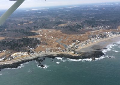
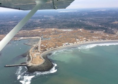
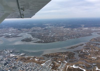
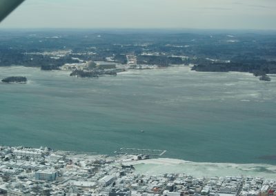
CAW members took to the sky on January 16 at low tide and January 23 at high tide. The planes were small; smaller than a VW bug inside. CAW Co-chair Steve Miller joined LightHawk pilots in Sanford, ME on the 16th and flew the coast from Portland, ME to Plum Island and inland to the Great Bay.
Steve: “The weather was partly cloudy and the views were spectacular. I was struck by the beauty of the winter colors of dull reds to rich browns in the salt marshes, and the water clarity in the ocean. All the different hues of blue ocean waters were dramatic. The other thing that struck me, flying at 1200 feet along the coast, is how much development we have that is right on the coast and in low lying areas. We saw structures that were located on bluffs or behind natural features that would protect them from storm surges. We also saw developments that had been constructed assuming static environmental conditions and are now very vulnerable to both rising seas and swelling salt marshes.”
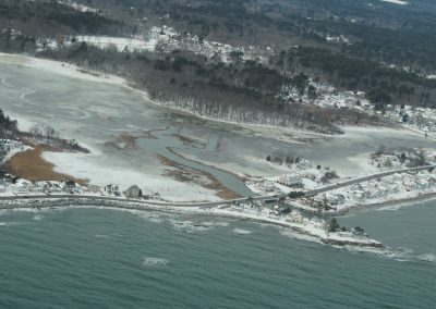
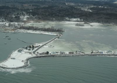
CAW member Jay Diener and Co-chair Sherry Godlewski flew at high tide on January 23. It had been very cold; the salt marshes and tidal rivers were coated with ice, offering a very different pallet than Steve’s flight. Their flights focused on NH’s coast, Great and Little Bay with a peek at Newburyport and Plum Island.
Jay: “The LightHawk flight was amazing! Looking down from a relatively low altitude gave me a unique perspective of our fragile coastal landscape. It was amazing to see the narrow ribbons of road, with homes on one or both sides. From the sky it was clear this ribbon of road and homes was all that separated the now, full salt marshes, from the ocean. Because it was high tide, every salt marsh we flew over was completely inundated, looking like massive, icy water bodies, and making the strips of land around those marshes appear even more fragile. Hampton’s salt marsh seemed to march right up to the back door of every home that sits on or near the edge of the marsh. I wondered if people who live there really understand how much water is lurking beyond those back doors. Most significant to me was that it was a calm day, with little wind and no storm surge. We saw from the ground, last March, what damage a coastal storm can do to roads, structures, and anything in its way. Looking at our landscape from the air makes it clear how gorgeous it is, but also how much risk there is to being on the coast, especially with sea level rise and increased storm activity.”
Being able to witness and document a King Tide from the sky helps us to understand our vulnerability. King Tides give us a glimpse of what our coast will look like as the sea and salt marshes around us continue to rise. We are very grateful to LightHawk for making these flights possible.
LightHawk is a non-profit organization that helps environmental experts collect data and landscape scale photographs to help them tell stories to inform the public and see the issues in a new way. LightHawk coordinates flights with volunteer pilots to get folks up in the air. “We believe seeing our world from above causes people to care about what they witness from the air and stirs them into action when they return to the ground.”
Steve Miller is the Coastal Training Program Coordinator at the NH Fish & Game Department Great Bay National Estuarine Research Reserve. Jay Diener is chairman of the Hampton, N.H. Conservation Commission and an active member of the Seabrook Hamptons Estuary Alliance. Sherry Godlewski is the Resilience and Adaptation Manager for the N.H. Department of Environmental Services.

